|
ATLANTIC
OCEAN:
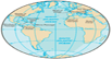
The Atlantic Ocean is the
second-largest of the world's oceans, with an area of about 106,460,000
km2 (41,100,000 sq mi). It covers approximately 20 percent of Earth's
surface and about 29 percent of its water surface area. It separates the
"Old World" from the "New World".

The Atlantic Ocean occupies an
elongated, S-shaped basin extending longitudinally between Europe and
Africa to the east, and the Americas to the west. As one component of
the interconnected World Ocean, it is connected in the north to the
Arctic Ocean, to the Pacific Ocean in the southwest, the Indian Ocean in
the southeast, and the Southern Ocean in the south (other definitions
describe the Atlantic as extending southward to Antarctica). The
Equatorial Counter Current subdivides it into the North(ern) Atlantic
Ocean and the South (ern) Atlantic Ocean at about 8°N.
Scientific explorations of the Atlantic include the Challenger
expedition, the German Meteor expedition, Columbia University's
Lamont-Doherty Earth Observatory and the United States Navy Hydrographic
Office.
Etymology
The Aethiopian
Ocean in a 1710 French map of Africa
The oldest known
mentions of an "Atlantic" sea come from Stesichorus around mid-sixth
century BC (Sch. A. R. 1. 211): Atlantikôi pelágei (Greek: Ἀτλαντικῷ
πελάγει; English: 'the Atlantic sea'; etym. 'Sea of Atlantis') and in
The Histories of Herodotus around 450 BC (Hdt. 1.202.4): Atlantis
thalassa (Greek: Ἀτλαντὶς θάλασσα; English: 'Sea of Atlantis' or 'the
Atlantis sea'[8]) where the name refers to "the sea beyond the pillars
of Heracles" which is said to be part of the sea that surrounds all
land.[9] In these uses, the name refers to Atlas, the Titan in Greek
mythology, who supported the heavens and who later appeared as a
frontispiece in Medieval maps and also lent his name to modern atlases.
On the other hand, to early Greek sailors and in Ancient Greek
mythological literature such as the Iliad and the Odyssey, this
all-encompassing ocean was instead known as Oceanus, the gigantic river
that encircled the world; in contrast to the enclosed seas well known to
the Greeks: the Mediterranean and the Black Sea. In contrast, the term
"Atlantic" originally referred specifically to the Atlas Mountains in
Morocco and the sea off the Strait of Gibraltar and the North African
coast. The Greek word thalassa has been reused by scientists for the
huge Panthalassa ocean that surrounded the supercontinent Pangaea
hundreds of millions of years ago.
The term "Aethiopian
Ocean", derived from Ancient Ethiopia, was applied to the
Southern Atlantic as late as the mid-19th century.[12] During the Age of
Discovery, the Atlantic was also known to English cartographers as the
Great Western Ocean.
The term The Pond is often
used by British and American speakers in context to the Atlantic Ocean,
as a form of meiosis, or sarcastic understatement. The term dates to as
early as 1640, first appearing in print in pamphlet released during the
reign of Charles I, and reproduced in 1869 in Nehemiah Wallington's
Historical Notices of Events Occurring Chiefly in The Reign of Charles
I, where "great Pond" is used in reference to the Atlantic Ocean by
Francis Windebank, Charles I's Secretary of State.
Extended Data
The International Hydrographic
Organization (IHO) defined the limits of the oceans and seas in
1953, but some of these definitions have been revised since then and
some are not used by various authorities, institutions, and countries,
see for example the CIA World Factbook. Correspondingly, the extent and
number of oceans and seas vary.
The Atlantic Ocean is
bounded on the west by North and South America. It connects to
the Arctic Ocean through the Denmark Strait, Greenland Sea, Norwegian
Sea and Barents Sea. To the east, the boundaries of the ocean proper are
Europe: the Strait of Gibraltar (where it connects with the
Mediterranean Sea—one of its marginal seas—and, in turn, the Black Sea,
both of which also touch upon Asia) and Africa.
In the
southeast, the Atlantic merges into the Indian
Ocean. The 20° East meridian, running south from Cape Agulhas to
Antarctica defines its border. In the 1953 definition it extends south
to Antarctica, while in later maps it is bounded at the 60° parallel by
the Southern Ocean.
The Atlantic has irregular
coasts indented by numerous bays, gulfs and seas. These include the
Baltic Sea, Black Sea, Caribbean Sea, Davis Strait, Denmark Strait, part
of the Drake Passage, Gulf of Mexico, Labrador Sea, Mediterranean Sea,
North Sea, Norwegian Sea, almost all of the Scotia Sea, and other
tributary water bodies.[1] Including these marginal seas the coast line
of the Atlantic measures 111,866 km (69,510 mi) compared to 135,663 km
(84,297 mi) for the Pacific.
Including its marginal seas,
the Atlantic covers an area of 106,460,000 km2 (41,100,000 sq mi) or
23.5% of the global ocean and has a volume of 310,410,900 km3
(74,471,500 cu mi) or 23.3% of the total volume of the earth's oceans.
Excluding its marginal seas, the Atlantic covers 81,760,000 km2
(31,570,000 sq mi) and has a volume of 305,811,900 km3 (73,368,200 cu
mi). The North Atlantic covers 41,490,000 km2 (16,020,000 sq mi) (11.5%)
and the South Atlantic 40,270,000 km2 (15,550,000 sq mi) (11.1%).[4] The
average depth is 3,646 m (11,962 ft) and the maximum depth, the
Milwaukee Deep in the Puerto Rico Trench, is 8,376 m (27,480 ft). (Wikipedia)
|